by Nikolai Khlystov, Ryan McCullough and Ryan Degnan*
But it is perhaps in agriculture that the impact is being felt particularly strongly and has the potential to transform how the sector operates by 2030.
Free or affordable space images traditionally have not been good enough to be meaningful on the ground and the ones with higher resolution have just been too expensive.
But that is changing now and over the next few years, both the cost and quality of imagery could be at a point where using it consistently could help deliver significant savings for farmers as well as help provide better planning for those working across the rest of the sector – everyone from logistics providers to insurance, governments and traders.
How space applications can benefit agriculture
As the Space Applications in Agriculture: Enhancing Food and Water Security, Improving Climate Action issue briefing published by the World Economic Forum in collaboration with McKinsey & Company highlights, space applications can deliver significant overall impact in agriculture over the coming years, but only if certain actions take place.
A few significant numbers in the report jump out. For example, identification of early-stage pests by hyperspectral and optical satellite imagery, if applied at scale, could help salvage up to 0.8 billion tonnes of crops annually.
Similarly, helping reduce inputs – such as pesticides and fertilizer – could save up to 50 million tonnes of carbon dioxide emissions per year, while water usage could be reduced by 5-10% – that’s up to 2.8 billion litres of fresh-water – from satellite-informed irrigation improvement.
Considering that the agricultural sector is a key global emitter of greenhouse gases and consumes close to two-thirds of global freshwater withdrawals, these numbers are important.
These societal benefits deliver economic returns as well. Food waste reduction could contribute an additional $150-175 billion in economic value for producers, according to analysis of data from the UN Food and Agriculture Organization, and a 5% cost reduction represents $7-8 billion for growers from input savings alone.
So how does this all work in practice? Space-based remote sensors collect and facilitate the exchange of a multitude of data, including weather information and imagery from optical, hyperspectral and multi-spectral domains, which can drive advanced analytics methods to provide insights in the field and across seasons.
We see these improving technologies, coupled with growing supply, bringing increased adoption over the next decade across five use cases:
Yield estimation: using satellite data and analytics to generate accurate and regionally specific estimates of expected crop production, by crop type, to quantify and act on food demand gaps, predict crop prices, or align logistics to harvest areas.
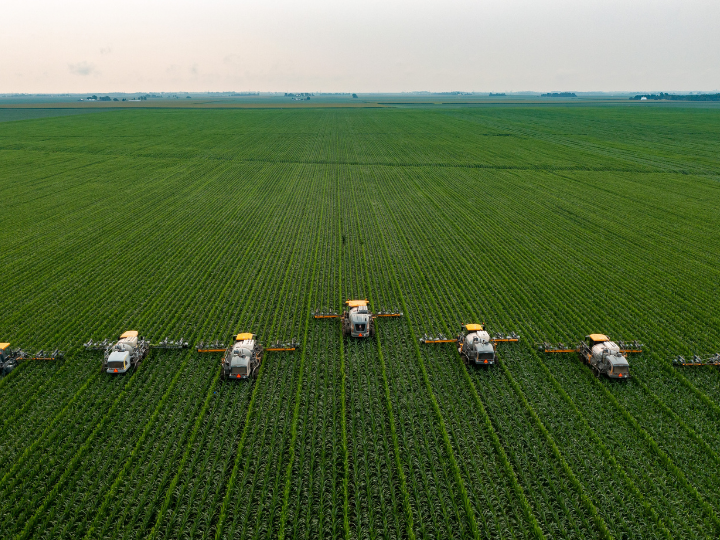
Yield optimization: using satellite data to power advanced analytics that identify intra-field crop defects, informing actions and operations to maximize production per acre by using resources more efficiently.
Bolstering sustainable practices: applying satellite insights to help reduce emissions, use less water, and encourage regenerative practices.
Predicting, verifying and mitigating damage from natural disasters with satellites’ unique ability to remotely monitor conditions before and after droughts, fires and floods.
Enabling autonomy and continuous monitoring via satellite-based connectivity in remote areas with poor mobile broadband coverage.
How satellites could be used in agriculture
For many of these use cases, satellites compete with unmanned aircraft vehicles, commonly known as UAVs or drones; fixed wing aircraft or high-altitude platforms such as balloons. However, satellites offer advantages at scale and eliminate the need for large, ground-based operations.
In some specific cases where extremely high resolution (3cm by 3cm) is needed or when there is persistent cloud cover, drones may still have a role in the future. But as satellite resolution improves and costs come down, these space-based tools could become an integral part of the sector.
Another likely scenario could see a hybrid model emerge, where a joint use of the different platforms can appear, with drones being used to verify data coming from satellites or providing sets of data which would be extrapolated to entire areas through satellite data with the help of artificial intelligence.
Importantly, we estimate the blended cost of high and very-high-resolution satellite imagery to decline 25% to 50% by 2030, bringing satellite imagery costs to a competitive level with that of equivalent-quality fixed wing and unmanned aerial vehicles, as their costs are likely to remain stable.
New customer groups, including carbon traders and insurers, are also likely to be attracted by what satellite data can provide, due to improved costs and operating models. In combination with expanding its reach to existing customers such as governments and the agriculture industry, we project adoption to grow the market ~10% annually and reach up to $1 billion by 2030.
In McKinsey & Company’s 2022 digital farmer adoption survey, 29% of row crop farmers and 45% of specialty crop farmers in the US said they currently employ remote sensing, or plan to, in the next two years and numbers are even higher in South America and Europe. With younger operators increasingly aging into management roles, adoption will increase – already 60% of users are under 44 years of age.
Co-ordinated efforts needed to increase uptake
Yet it will take coordinated efforts among disparate stakeholders to make greater adoption a reality. Greater confidence can be achieved by involving users in the technology development roadmaps, ensuring a tight linkage between user needs and insights.
Providing transparency into how insights are derived, highlighting where they are most accurate or fall short, is also critical for building trust. Ultimately, testimonials and proven value creation will be the true test.
Getting model accuracy to reliable levels requires a high investment of manpower, while data gathered on the ground is required to train analytics models and validate what the images predict. Such data is costly and will require substantial cross-industry collaboration.
Archival imagery and real time imagery will be required by satellite companies to help insight developers train their algorithms, while growers should ensure ground-truth data availability by leveraging cooperatives, commodity boards, and other networks.
Governments, non-governmental organizations and analytics companies can make data-sharing easy, anonymous and beneficial for growth to growers who participate.
Commercial satellite applications have therefore an opportunity to become a much bigger part of the agriculture sector over the coming years, and everybody stands to gain.
*Lead, Space, and Lead, Global Future Council on Space, World Economic Forum and Partner, McKinsey & Company and Management Consultant, McKinsey & Company
**first published in: Weforum.org
 By: N. Peter Kramer